Benchmarks of Oxford Road

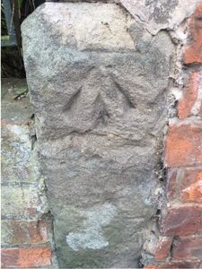
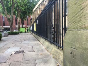
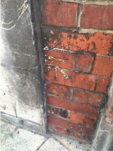
My colleague John Moore pointed out a couple of cut mark Ordnance Survey benchmarks on and around Oxford Road. This prompted me to look up the nearest benchmarks and find them. I’ll keep updating this post as I photograph them – some are currently off-limits because of building work, others have likely been destroyed. These marks are a legacy of a need for marks for local surveyors using optical levels, alidades, chains and plane tables – these marks are no longer maintained by the Ordnance Survey. A modern surveyor will use a GPS receiver that uses a correction signal from a receiver located on a known position – the organisation provides an “active” network of continuously running transceivers on known positions, and a “passive” network of survey marks with published positions upon which a surveyor may locate their own transceiver.
 

IMG_0232
SJ84749641, Holy Name Roman Catholic Church, south-east face, south angle. 38.045m O.D.


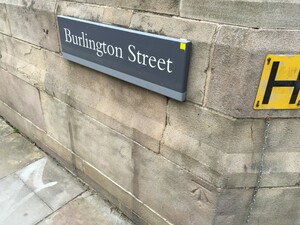
SJ84629652, Wall north-west side of Oxford Road, junction with Burlington St, south-east face. 38.057m O.D.
SJ84629652, Wall north-west side of Oxford Road, junction with Burlington St, south-east face. 38.057m O.D. Note the retro target on the street sign – someone has been busy levelling using a Total Station!


SJ84919621, Building south-east side Nelson Street, north-west face, north angle. 39.542m O.D. This is on the side of Emmeline Pankhurst's house.
SJ84919621, Building south-east side Nelson Street, north-west face, north angle. 39.542m O.D. This is on the side of Emmeline Pankhurst’s house.


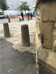
SJ84549648, P Wall, junction north-west side road, south-east face. 36.698m O.D.


This mark
SJ84914621, Corner of the Eye Hospital and Nelson Street. 39.54m O.D. This mark wasn’t listed on the OS list I obtained, but I noticed it as I walked to the mark on the side of Emmeline Pankhurst’s house. It appears on an 80’s OS Map.
  • SJ84849678, Number 81 Upper Brook Street, north-west face, west angle. 38.868m O.D. – No longer extant.
  • SJ84579662, Museum, west side Oxford Road, south side gateway, north-east face, north angle. 38.384m O.D. Obscured by building works at present.